Mexico

MACROLOTE WITH VIEWS TO TILOXTOC 60 HECTARESMACROLOTE CON VISTAS A TILOXTOC 60 HECTAREAS

Saved Save
1 of 37
2 of 37: VISTA DRON DESDE INICIO DEL POLIGONO PARTE ALTA
VISTA DRON DESDE INICIO DEL POLIGONO PARTE ALTA
3 of 37: POLIGONO COMPLETO
POLIGONO COMPLETO
4 of 37: VISTA DESDE EL FINAL DE LINDERO
VISTA DESDE EL FINAL DE LINDERO
5 of 37
6 of 37: CAMINO DE CNA
CAMINO DE CNA
7 of 37: VISTAS HACIA TILOXTOC
VISTAS HACIA TILOXTOC
8 of 37: PARTE DE ACCESO RESTRINGIDO HACIA EL SILO DE AGUA
PARTE DE ACCESO RESTRINGIDO HACIA EL SILO DE AGUA
9 of 37: VISTAS DESDE EL CAMINO DE LA PUNTA
VISTAS DESDE EL CAMINO DE LA PUNTA
10 of 37: CAMINO AL SILO
CAMINO AL SILO
11 of 37: PARTE ALTA DE LA PUNTA
PARTE ALTA DE LA PUNTA
12 of 37: INICIO DEL POLIGONO
INICIO DEL POLIGONO
13 of 37: AEREA DEL PREDIO
AEREA DEL PREDIO
14 of 37
15 of 37
16 of 37: POLIGONO
POLIGONO
17 of 37
18 of 37: BARRANCA LADO NORTE
BARRANCA LADO NORTE
19 of 37
20 of 37
21 of 37
22 of 37: VISTAS AMPLIAS A LOS VALLES DE TILOXTOC
VISTAS AMPLIAS A LOS VALLES DE TILOXTOC
23 of 37: POLIGONO
POLIGONO
24 of 37: LA CALLE ES EL LINDERO
LA CALLE ES EL LINDERO
25 of 37: SE LLEGA EN CAMIONETA 4X4
SE LLEGA EN CAMIONETA 4X4
26 of 37: OJO DE AGUA DENTRO DEL POLIGNO
OJO DE AGUA DENTRO DEL POLIGNO
27 of 37: LINDERO CON RANCHO ORTEGA
LINDERO CON RANCHO ORTEGA
28 of 37: LINDERO CON CNA
LINDERO CON CNA
29 of 37: VISTAS HACIA TILOXTOC
VISTAS HACIA TILOXTOC
30 of 37: LINDERO CON EL VECINO PARTE BAJA
LINDERO CON EL VECINO PARTE BAJA
31 of 37: COLINDANCIA CON EJIDO VALLE DE BRAVO
COLINDANCIA CON EJIDO VALLE DE BRAVO
32 of 37: CAMINO, DE LA  PARTE ALTA
CAMINO, DE LA PARTE ALTA
33 of 37: PARTE ALTA CON POCOS ARBOLES
PARTE ALTA CON POCOS ARBOLES
34 of 37: VISTA DESDE LA PARTE MAS ALTA
VISTA DESDE LA PARTE MAS ALTA
35 of 37
36 of 37: EARTH DEL POLIGONO Y VECINOS
EARTH DEL POLIGONO Y VECINOS
37 of 37: EARTH DEL MUNICIPIO
EARTH DEL MUNICIPIO
1 of 37
1 / 37
2 of 37: VISTA DRON DESDE INICIO DEL POLIGONO PARTE ALTA
2 / 37
VISTA DRON DESDE INICIO DEL POLIGONO PARTE ALTA
3 of 37: POLIGONO COMPLETO
3 / 37
POLIGONO COMPLETO
4 of 37: VISTA DESDE EL FINAL DE LINDERO
4 / 37
VISTA DESDE EL FINAL DE LINDERO
5 of 37
5 / 37
6 of 37: CAMINO DE CNA
6 / 37
CAMINO DE CNA
7 of 37: VISTAS HACIA TILOXTOC
7 / 37
VISTAS HACIA TILOXTOC
8 of 37: PARTE DE ACCESO RESTRINGIDO HACIA EL SILO DE AGUA
8 / 37
PARTE DE ACCESO RESTRINGIDO HACIA EL SILO DE AGUA
9 of 37: VISTAS DESDE EL CAMINO DE LA PUNTA
9 / 37
VISTAS DESDE EL CAMINO DE LA PUNTA
10 of 37: CAMINO AL SILO
10 / 37
CAMINO AL SILO
11 of 37: PARTE ALTA DE LA PUNTA
11 / 37
PARTE ALTA DE LA PUNTA
12 of 37: INICIO DEL POLIGONO
12 / 37
INICIO DEL POLIGONO
13 of 37: AEREA DEL PREDIO
13 / 37
AEREA DEL PREDIO
14 of 37
14 / 37
15 of 37
15 / 37
16 of 37: POLIGONO
16 / 37
POLIGONO
17 of 37
17 / 37
18 of 37: BARRANCA LADO NORTE
18 / 37
BARRANCA LADO NORTE
19 of 37
19 / 37
20 of 37
20 / 37
21 of 37
21 / 37
22 of 37: VISTAS AMPLIAS A LOS VALLES DE TILOXTOC
22 / 37
VISTAS AMPLIAS A LOS VALLES DE TILOXTOC
23 of 37: POLIGONO
23 / 37
POLIGONO
24 of 37: LA CALLE ES EL LINDERO
24 / 37
LA CALLE ES EL LINDERO
25 of 37: SE LLEGA EN CAMIONETA 4X4
25 / 37
SE LLEGA EN CAMIONETA 4X4
26 of 37: OJO DE AGUA DENTRO DEL POLIGNO
26 / 37
OJO DE AGUA DENTRO DEL POLIGNO
27 of 37: LINDERO CON RANCHO ORTEGA
27 / 37
LINDERO CON RANCHO ORTEGA
28 of 37: LINDERO CON CNA
28 / 37
LINDERO CON CNA
29 of 37: VISTAS HACIA TILOXTOC
29 / 37
VISTAS HACIA TILOXTOC
30 of 37: LINDERO CON EL VECINO PARTE BAJA
30 / 37
LINDERO CON EL VECINO PARTE BAJA
31 of 37: COLINDANCIA CON EJIDO VALLE DE BRAVO
31 / 37
COLINDANCIA CON EJIDO VALLE DE BRAVO
32 of 37: CAMINO, DE LA  PARTE ALTA
32 / 37
CAMINO, DE LA PARTE ALTA
33 of 37: PARTE ALTA CON POCOS ARBOLES
33 / 37
PARTE ALTA CON POCOS ARBOLES
34 of 37: VISTA DESDE LA PARTE MAS ALTA
34 / 37
VISTA DESDE LA PARTE MAS ALTA
35 of 37
35 / 37
36 of 37: EARTH DEL POLIGONO Y VECINOS
36 / 37
EARTH DEL POLIGONO Y VECINOS
37 of 37: EARTH DEL MUNICIPIO
37 / 37
EARTH DEL MUNICIPIO
Close
ID: EB-LF1770
Published
$50,000,000
For Sale

MACROLOTE WITH VIEWS TO TILOXTOC 60 HECTARESMACROLOTE CON VISTAS A TILOXTOC 60 HECTAREAS

Lot in Santa Magdalena Tilostoc, Valle de Bravo

AQUA bienes raices
Published by AQUA bienes raices
AQUA BIENES RAICES
60 ha Lot Size
Description
View originalView in English

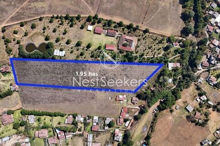
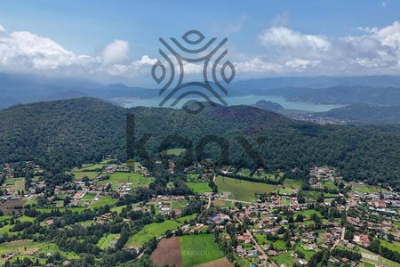
A unique property for sale in the entire municipality of Valle de Bravo.

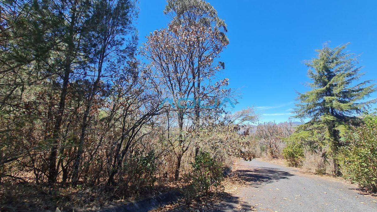
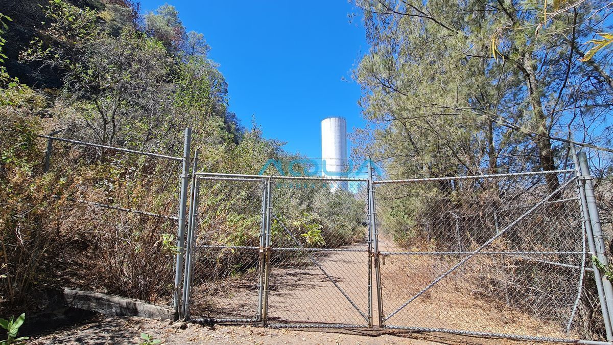
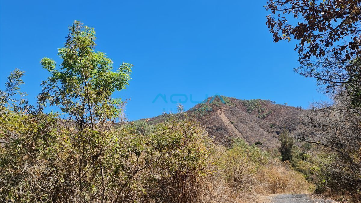
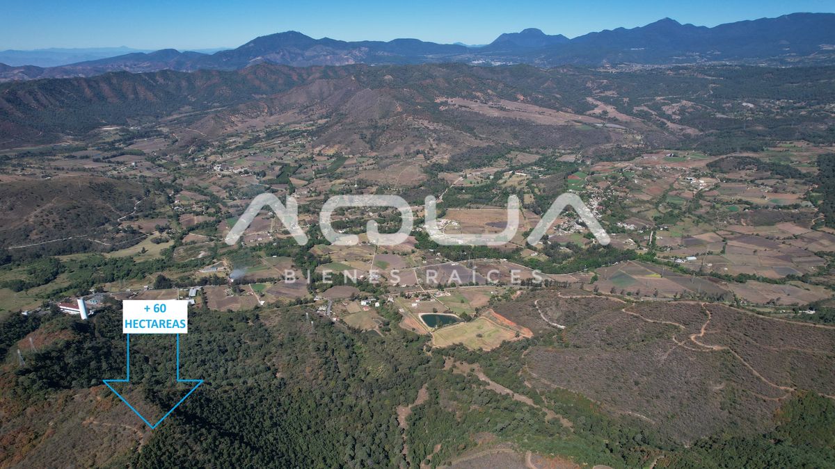
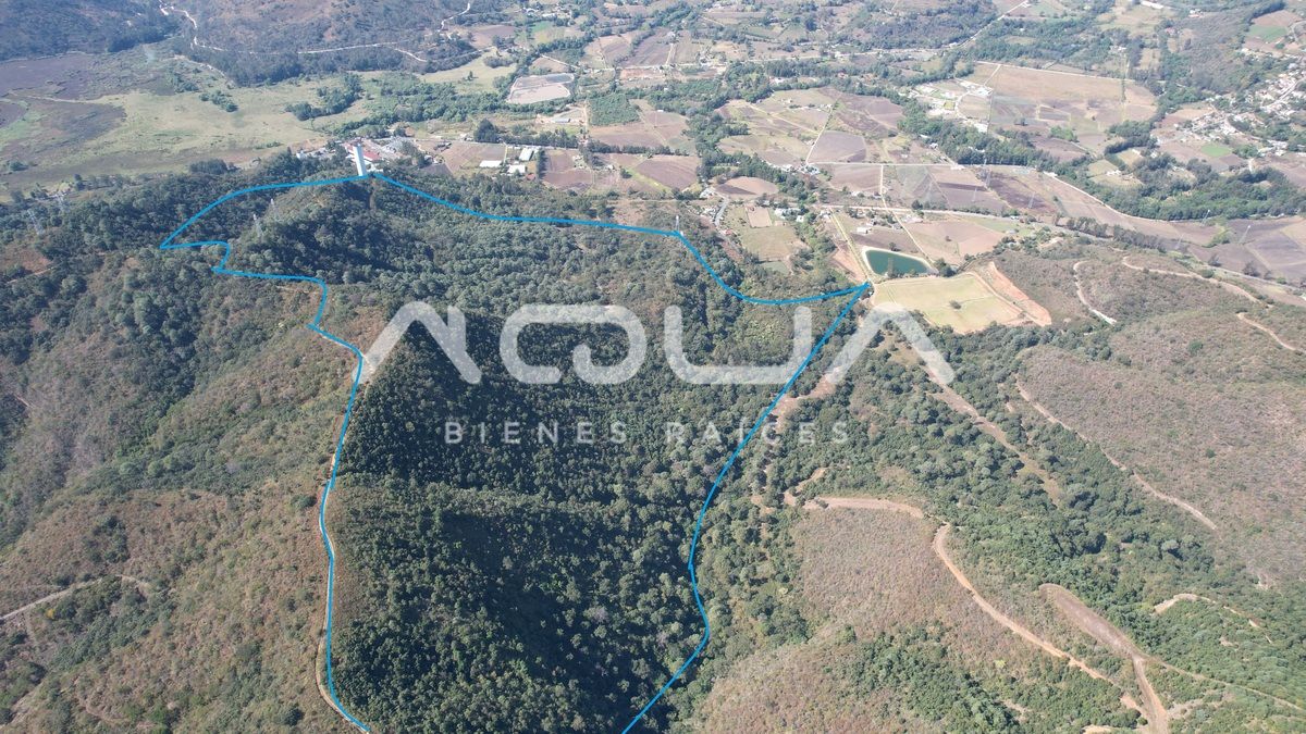
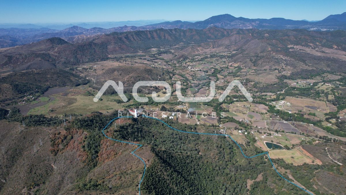
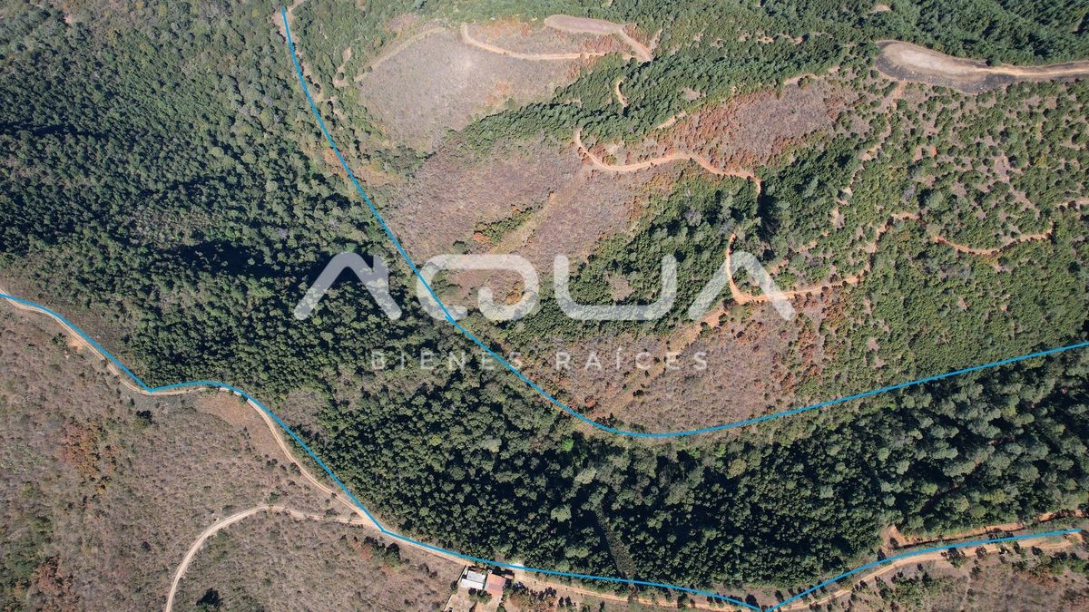
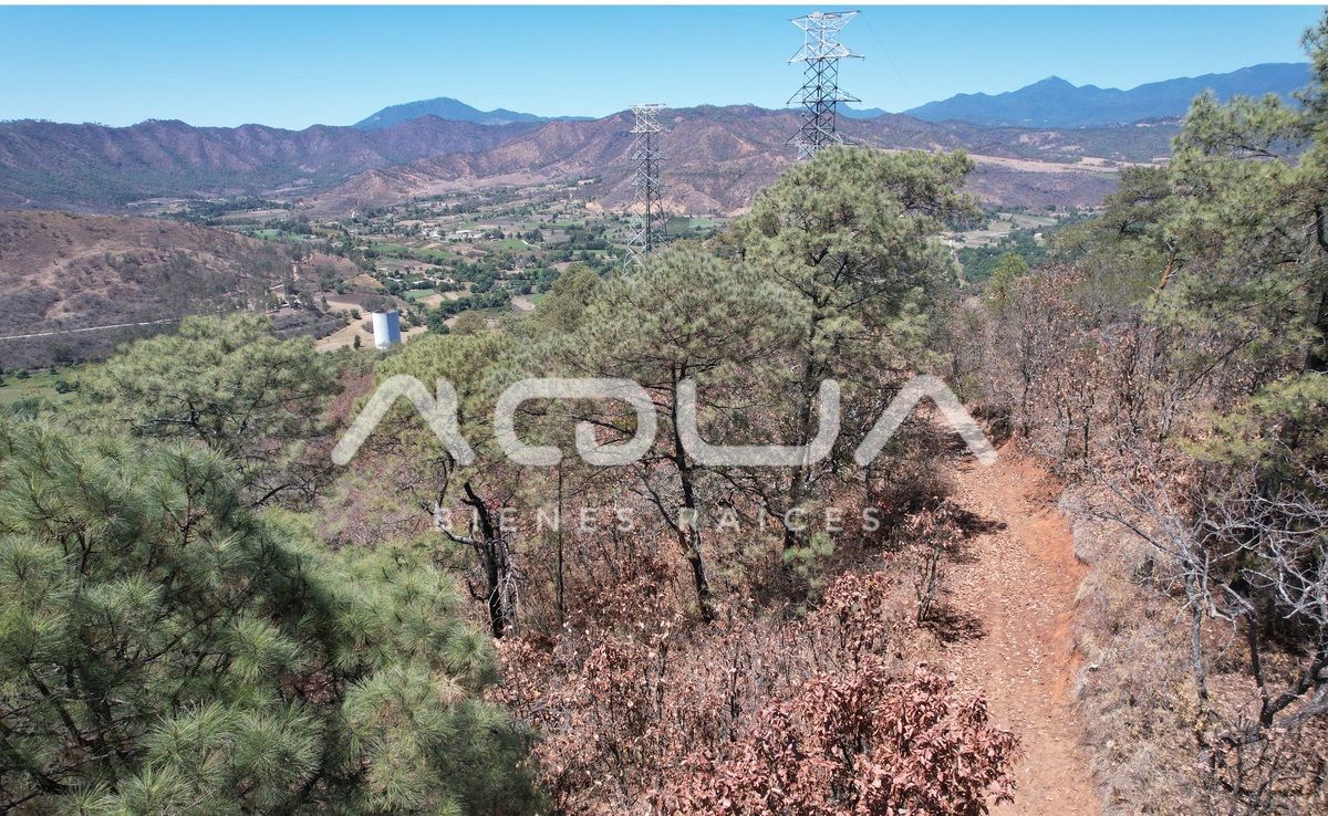
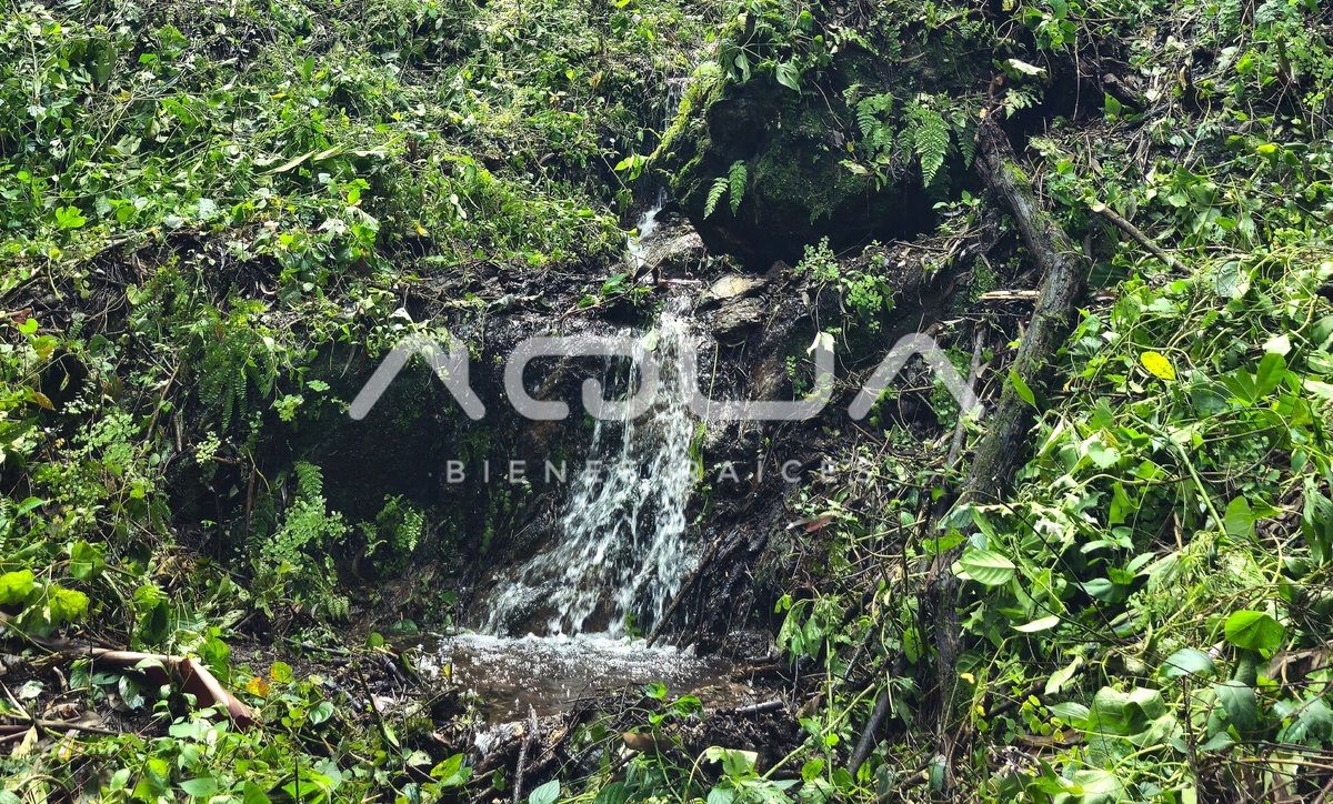
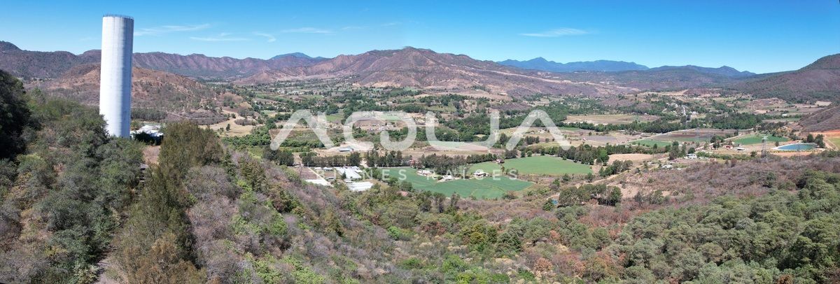
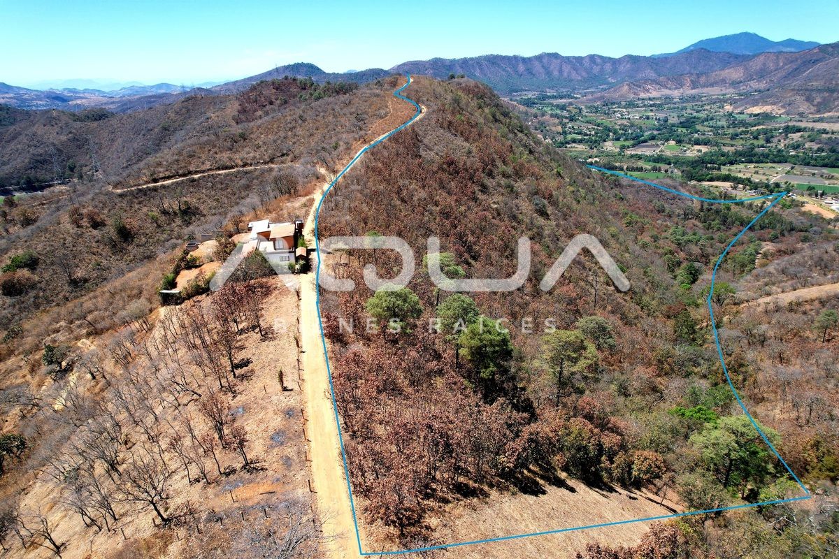
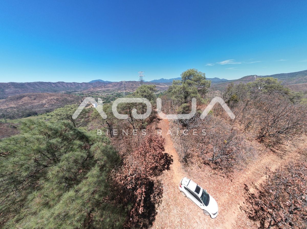
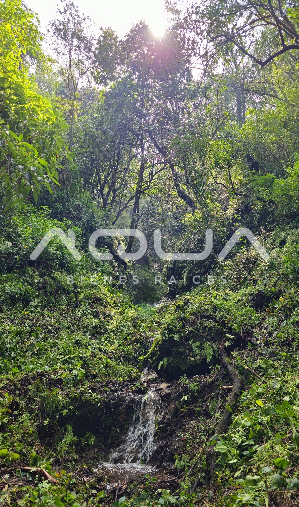
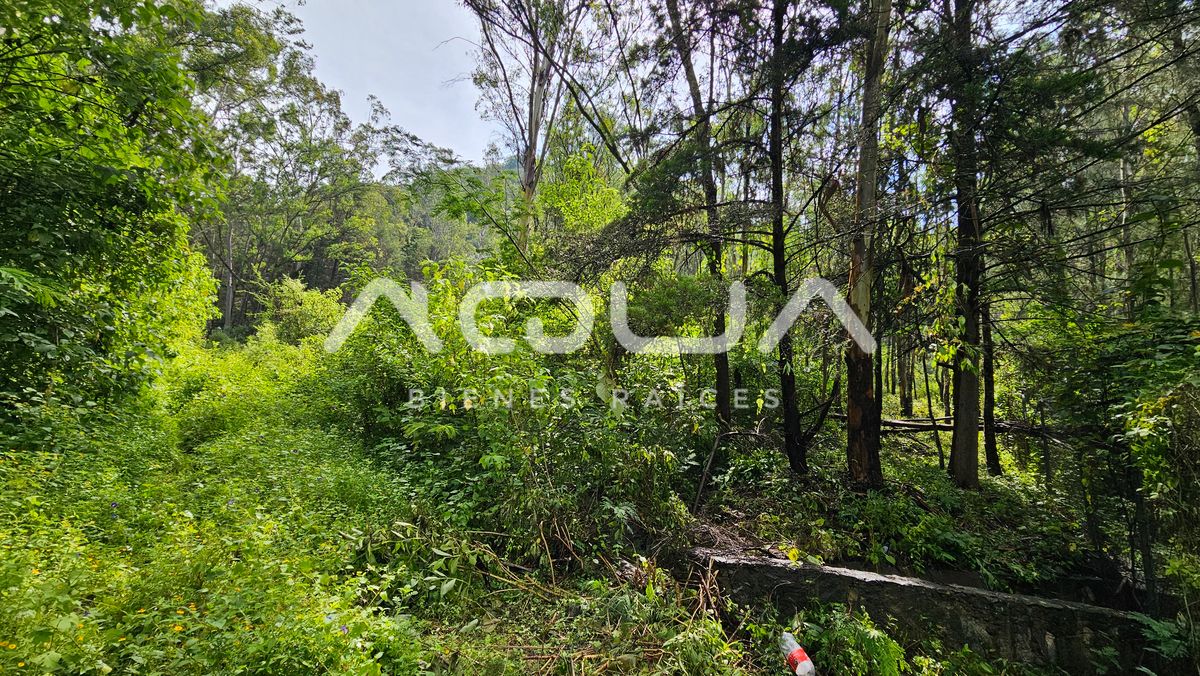
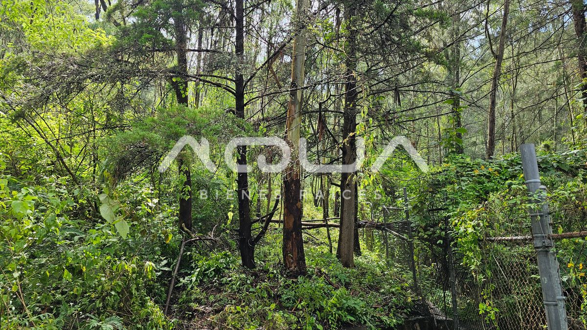
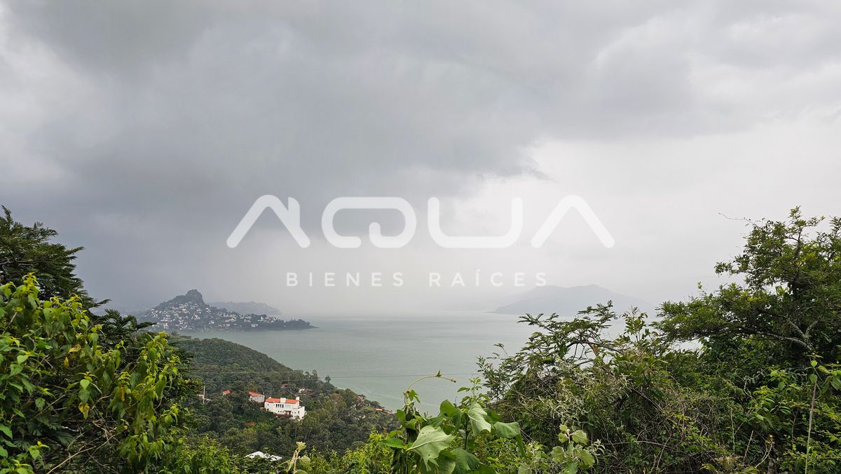
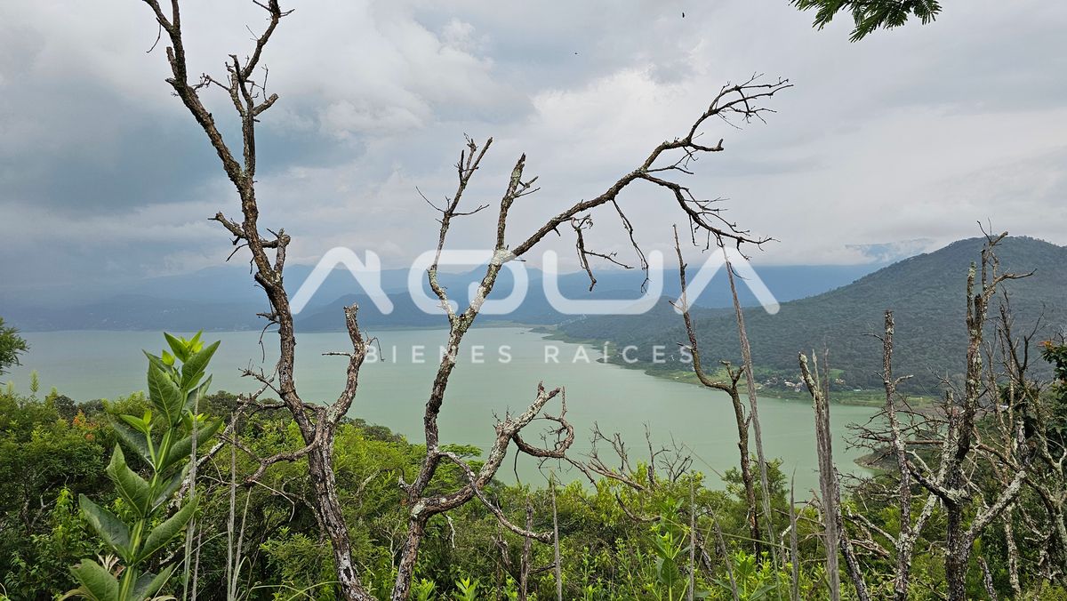
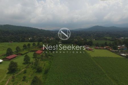
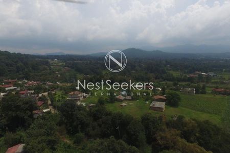
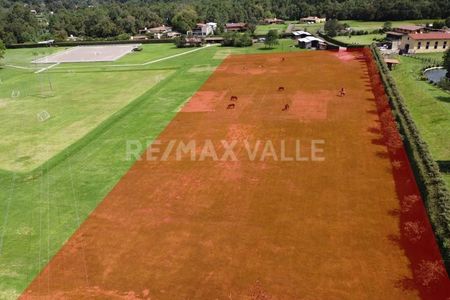
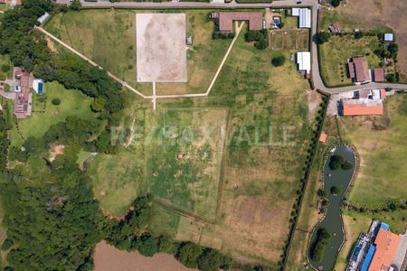
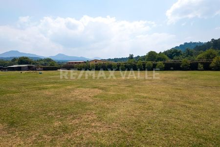
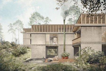
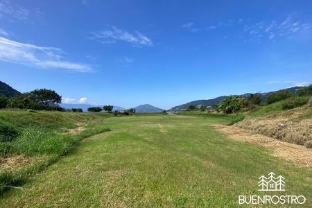
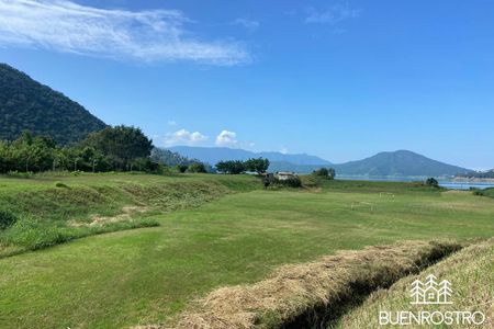
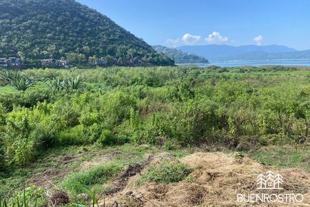
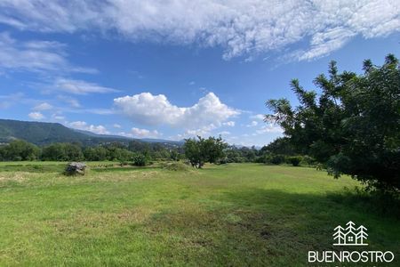
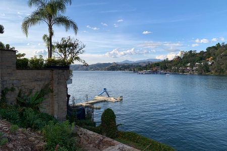
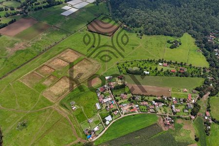
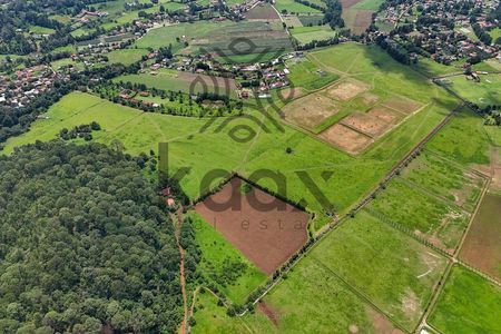
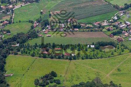
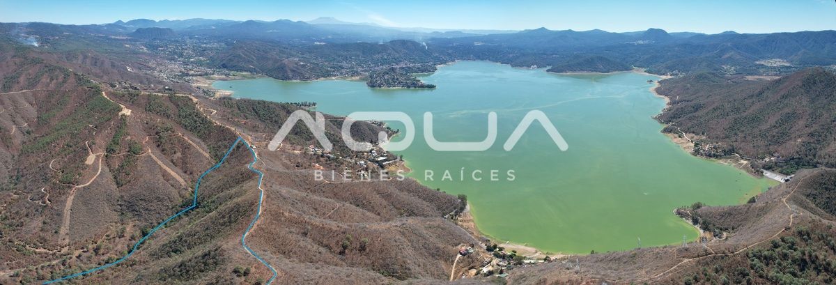
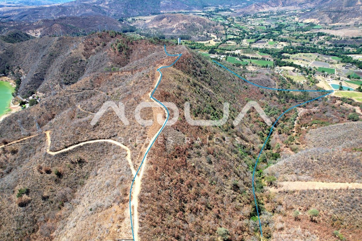
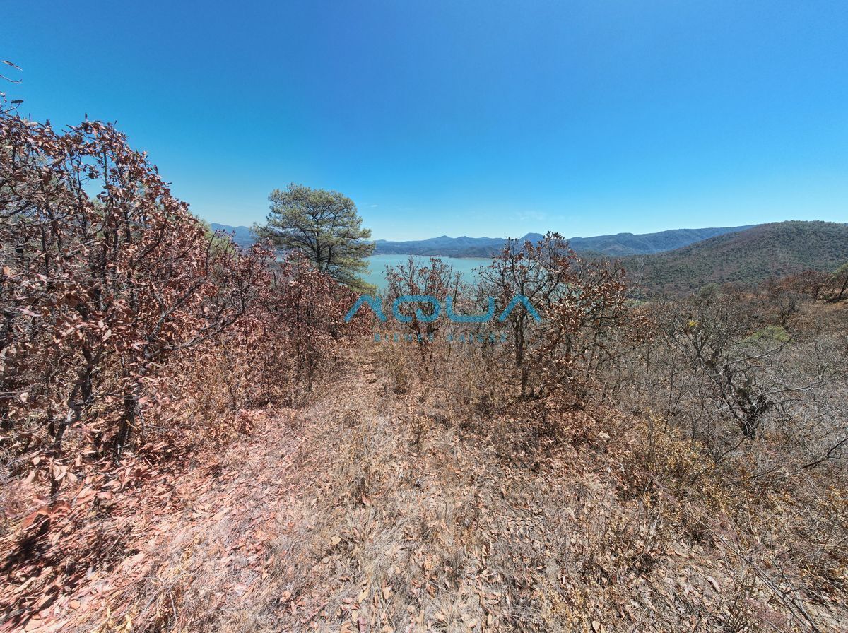
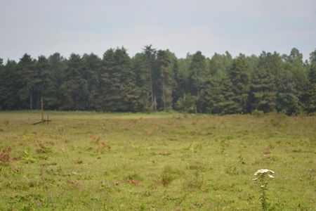
First, due to its size, more than 60 hectares of native forests, as it is an area with little impact from human hands, only 2 water silos and an electricity tower that do not affect the use of the area.

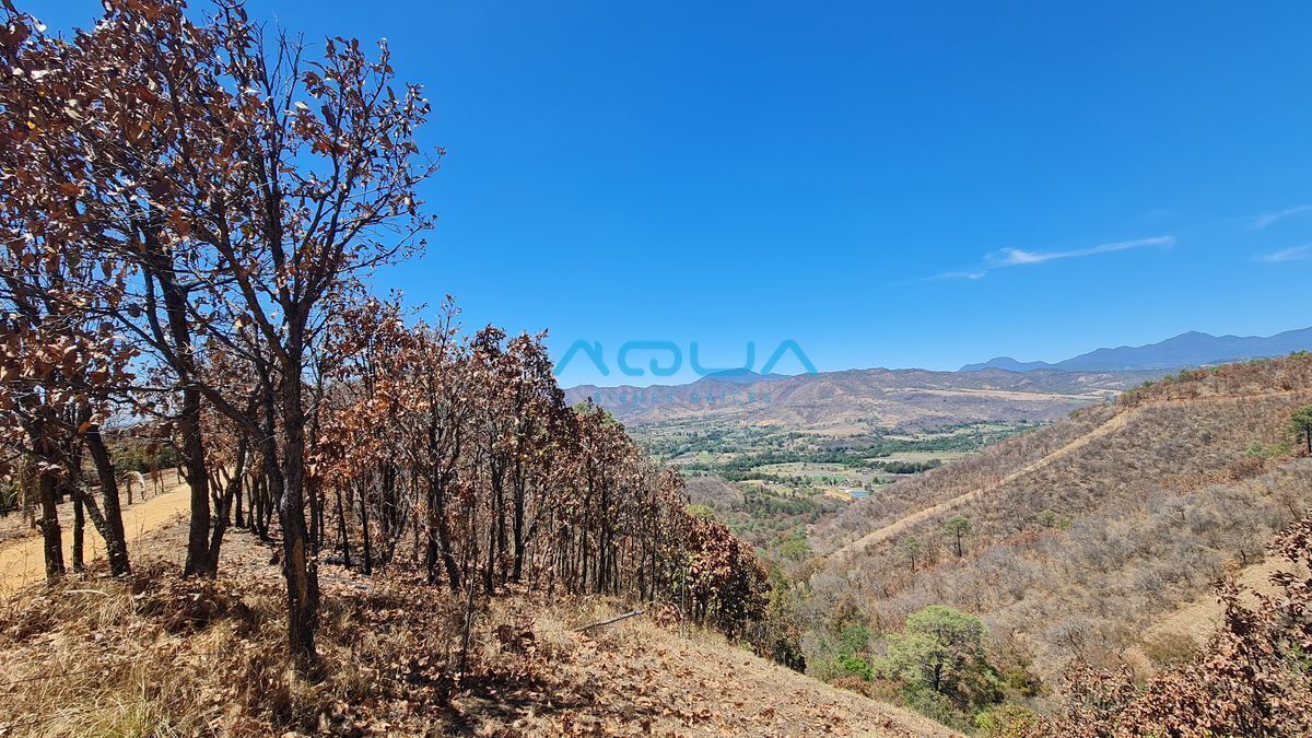
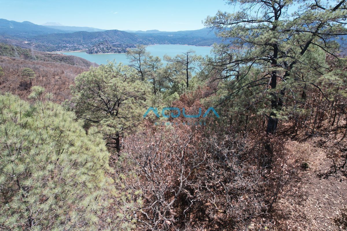
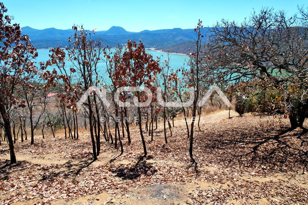
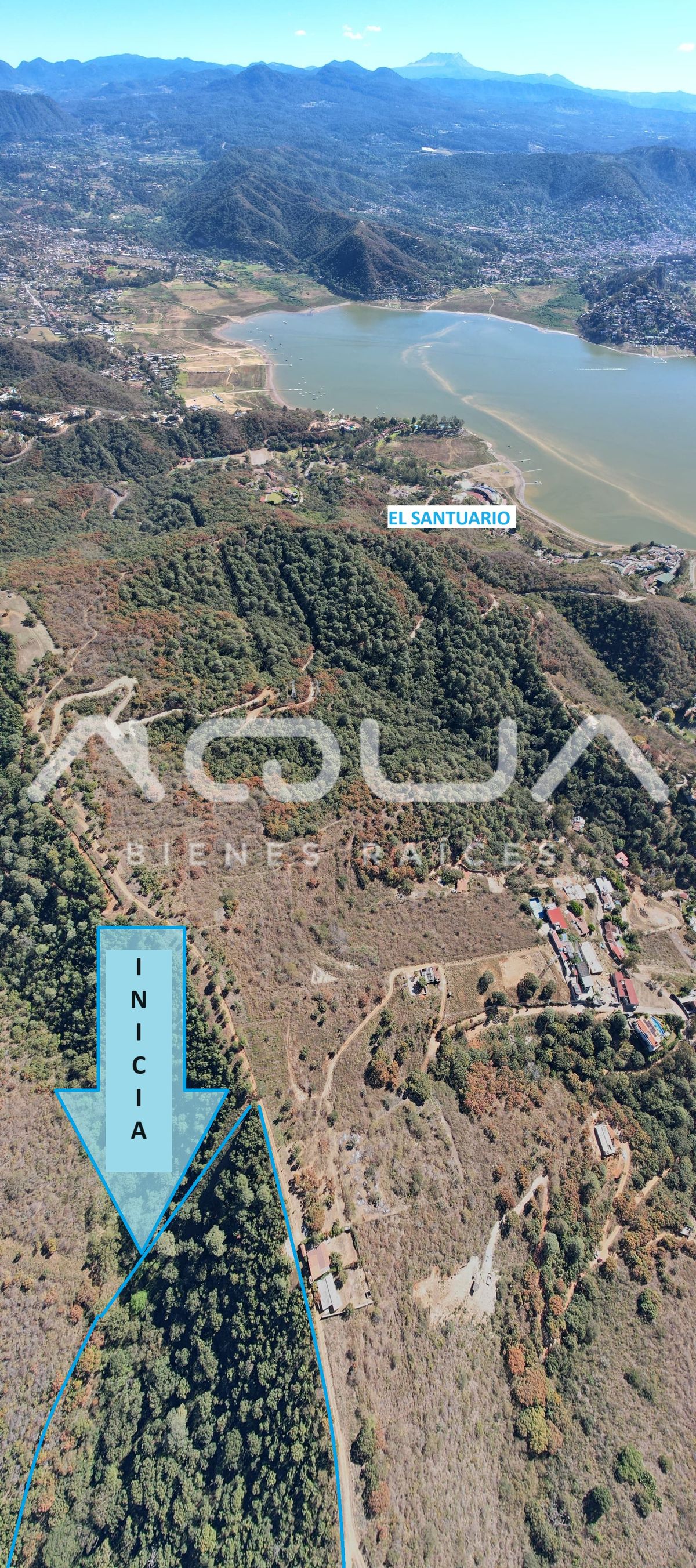
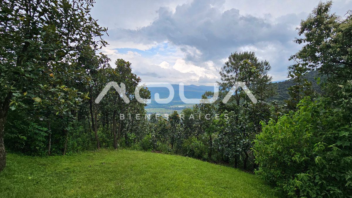
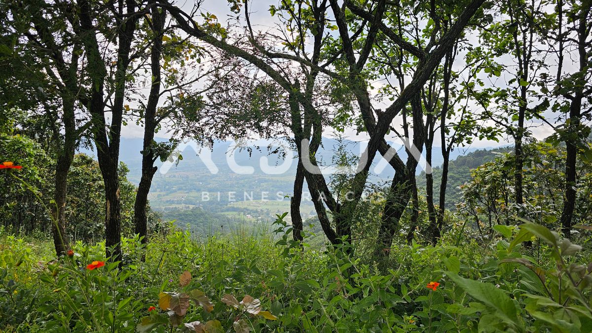
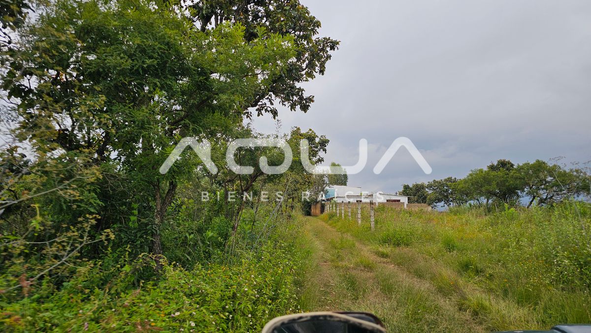
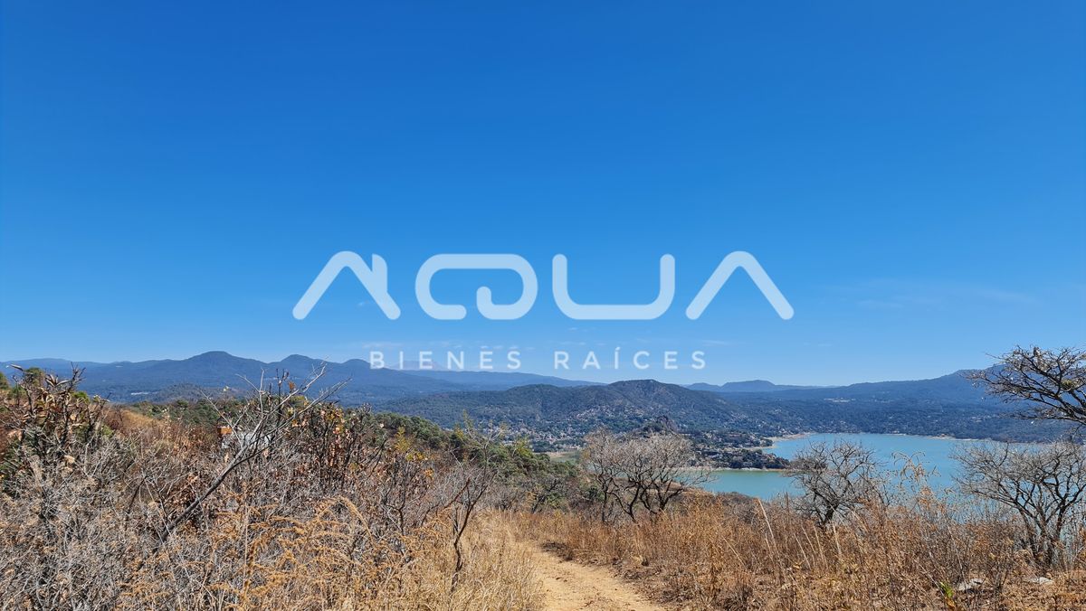
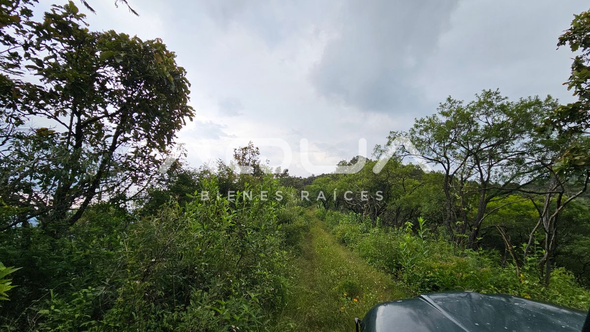
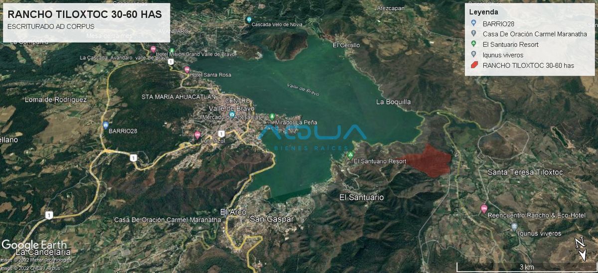
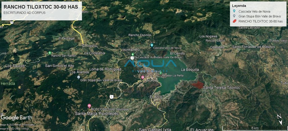
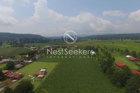
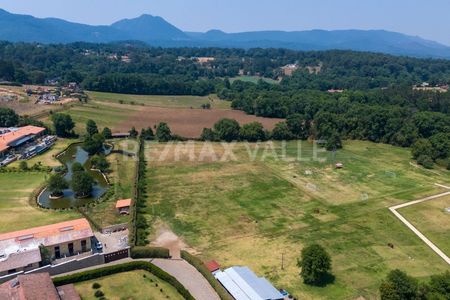
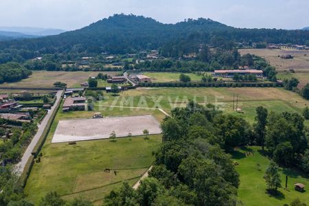
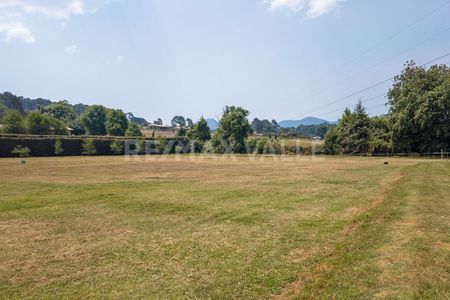
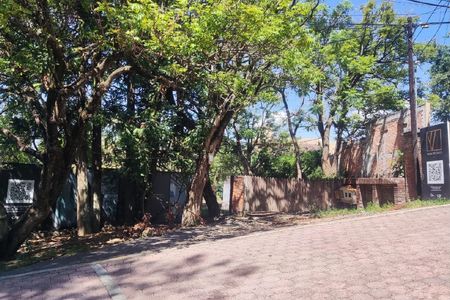
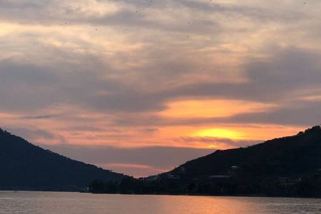
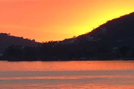
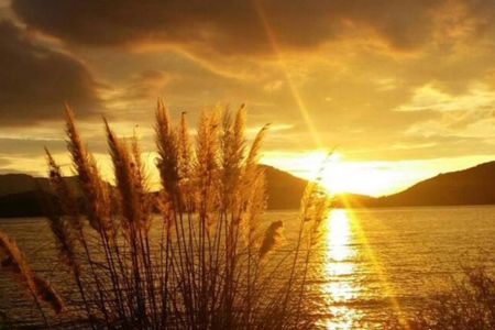
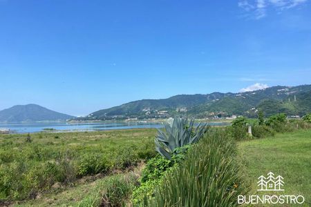
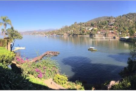
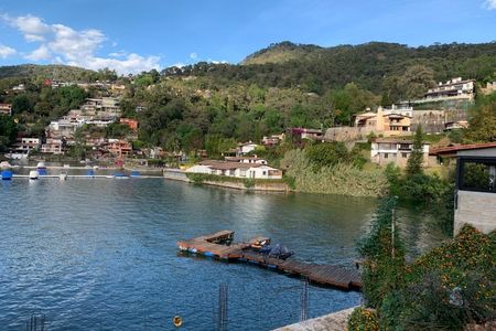
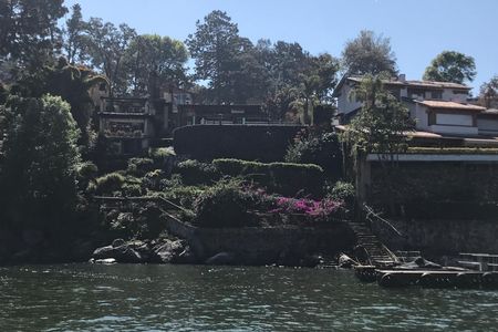
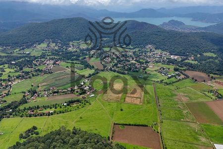
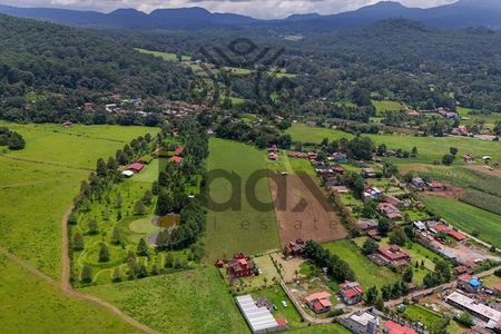
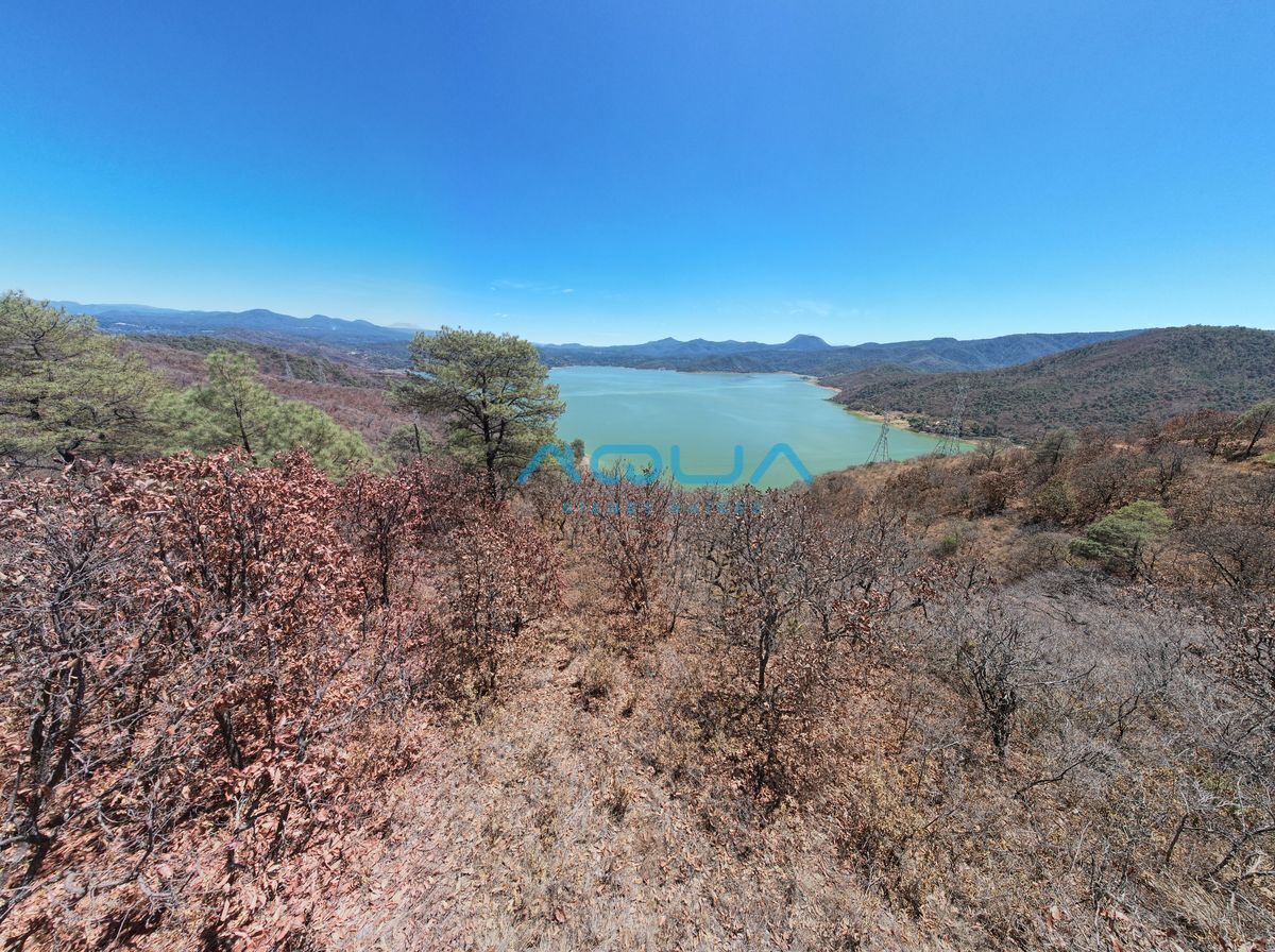
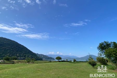
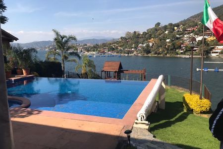
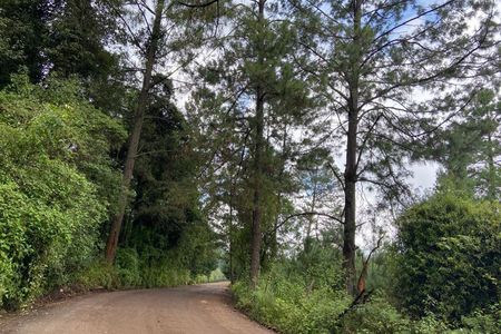
Secondly, it has double access; the first is 2 km past the Sanctuary, the first stretch is cobblestone, and the last kilometer uphill is dirt road by the hill next to the Ortega bridge. Right at the end of the road, we reach the crest of the hill, which has incredible views of the lake. The other access is past pumping station 2 of the Cutzamala system; this entrance is completely paved and leads directly to halfway up the hill to maintain the water silo, this road is within the property.

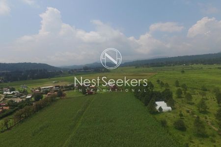
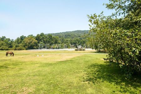
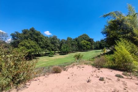
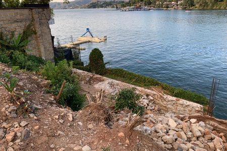
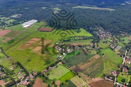
Thirdly, the property borders the entire northern boundary with an irrigation canal from the ejido of Santa Magdalena Tiloxtoc, so access to water is guaranteed, only that the property by that entrance is an ascending slope, so a pumping system will be necessary, or the houses that are built at the top of the hill to take advantage of the views should have their own rainwater collection and storage system.

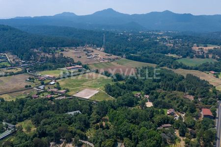
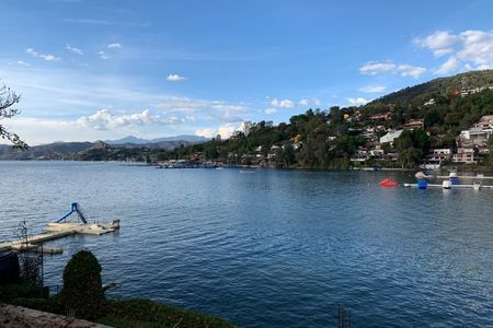
Finally, the price, less than $100 per m2 makes the property the most attractive for investment in the entire municipality, especially considering it is an area of large developments, such as El Santuario, Rancho Dos Rios, and the mega project of architect Sordo Madaleno: Valle San Nicolás, which has just added a couple of hundred hectares to continue developing.

If you already know the area, you know the potential that awaits; if not, make an appointment, and we will gladly take you to see it.

Lead advisor: Alan Salinas
Una propiedad en venta unica en todo el municipio de Valle de Bravo.

Primero por su tamaño, mas de 60 hectareas de bosques nativos, pues se trata de un area con poco impacto por la mano del hombre, solo 2 silos de agua y una torre de electricidad que no afectan el aprovechamiento del area.

En segundo lugar tiene doble acceso, el primero es a 2 kms pasando el Santuario, el primer tramo es empedrado y el ultimo kilometro de subida es terracería por el cerro contiguo al puente de Ortega, justo al final del camino llegamos a la cresta del cerro, el cual tiene increíbles vistas al lago, el otro acceso es pasando la planta de bombeo 2 del sistema Cutzamala, esta entrada esta completamente asfaltada y lleva directo a media cerro, para dar mantenimiento al silo de agua, este camino queda dentro de la propiedad.

En tercero es que el predio colinda en todo el lindero norte con un canal de riego del ejido de Santa Magdalena Tiloxtoc por lo que el acceso al agua esta garantizado, solo que el predio por esa entrada es pendiente ascendente por lo que un sistema de bombeo será necesario o bien que las casas que se construyan en la punta del cerro para aprovechar las vistas tengan su propio sistema de captación pluvial y almacenamiento.

Finalmente el precio, menos de $100x m2 lo hace el predio mas atractivo para invertir en todo el municipio y mas tratándose de una zona de grandes desarrollos, como El Santuario, Rancho Dos Rios y el mega proyecto del arquitecto Sordo Madaleno: Valle San Nicolás, que acaba de agregar un par de cientos de hectáreas para seguir desarrollando.

Si ya ubicas la zona, sabes del potencial que aguarda, si no saca una cita con gusto te llevamos a conocerla.

Asesor titular: Alan Salinas

Location
Copy link

Santa Magdalena Tilostoc, Valle de Bravo, Estado De México

Similar properties
AQUA bienes raices
AQUA bienes raices
AQUA BIENES RAICES
Send message